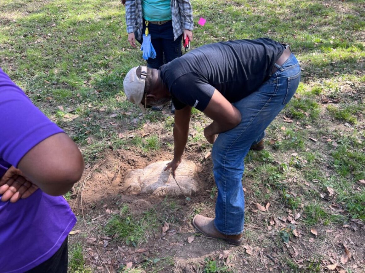
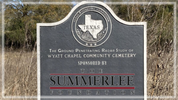
On March 31, 2024, archaeologists Dr. Chet Walker and Aundrea Thompson returned to the campus of Prairie View A&M University (PVAMU) to complete their geophysical examinations of the historic burial ground of Wyatt Chapel Community Cemetery.
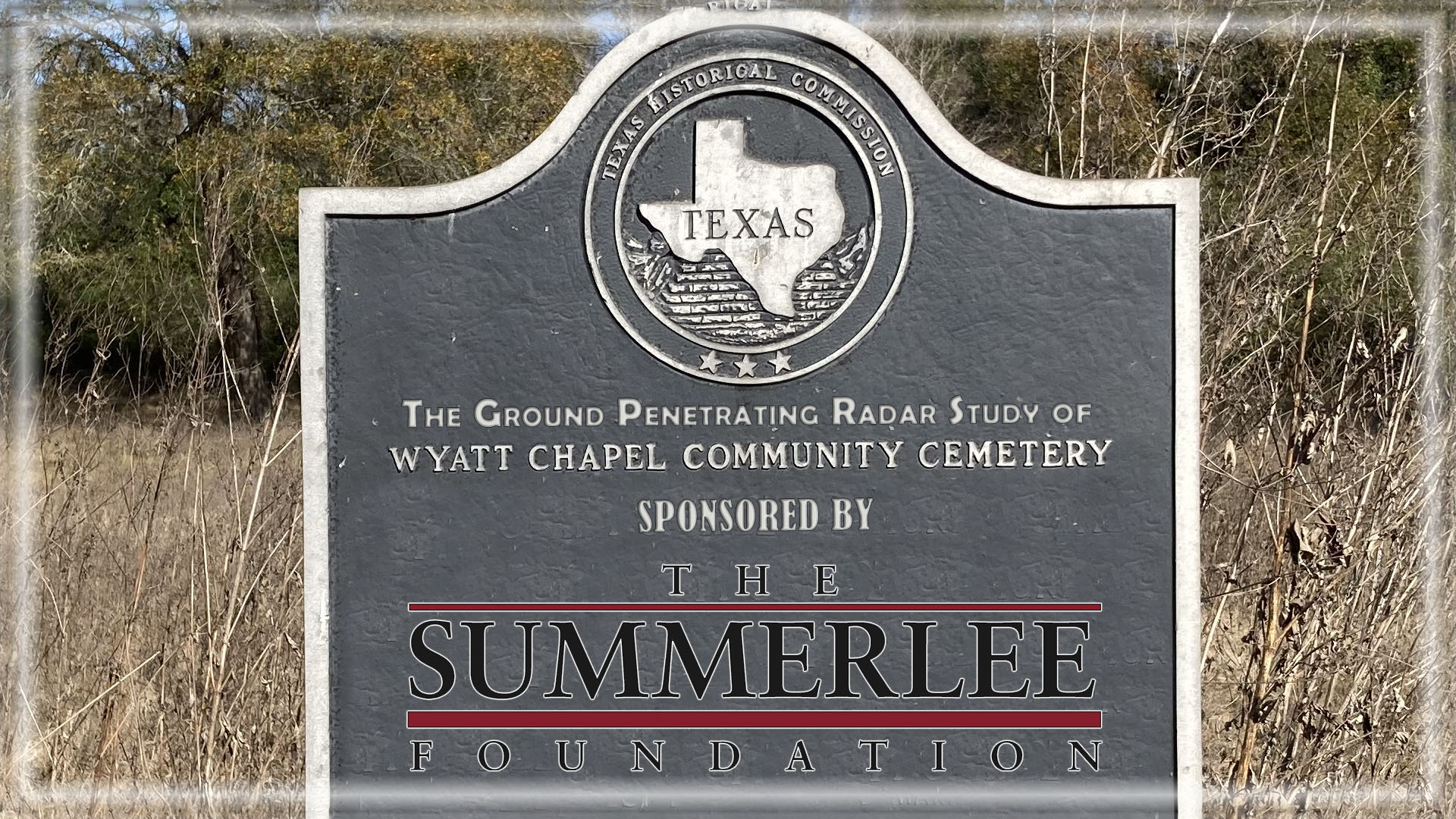
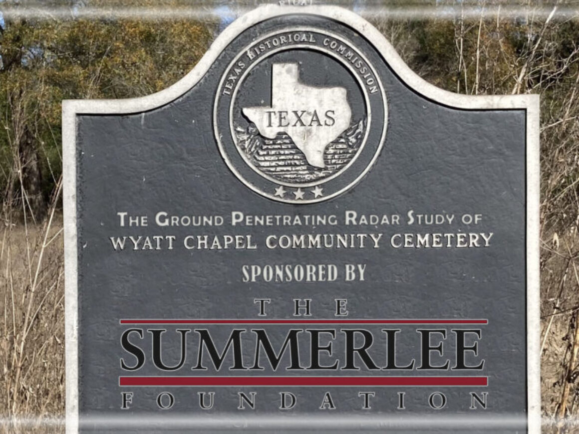
This project is funded through the Summerlee Foundation.
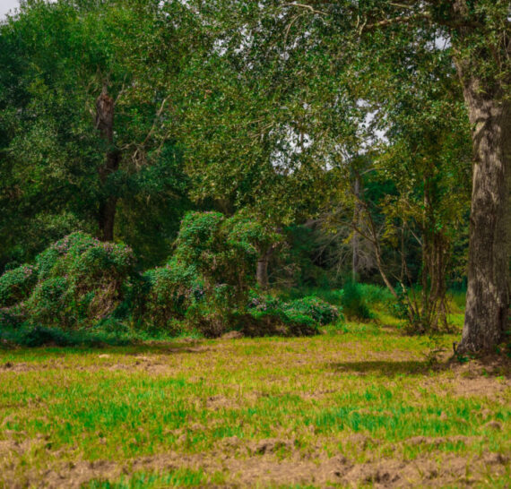
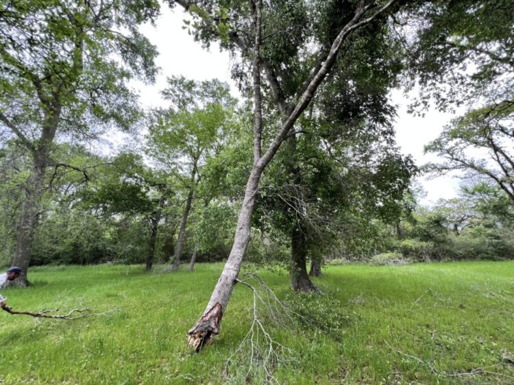
Broken Trees in the Cemetery
Dr. Chet Walker came back to the cemetery following a massive storm that left several trees broken near the entrance to the cemetery.
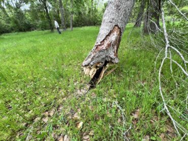
The Bottom of the Tree
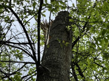
The top of this tree was broken off and laying on the ground
Storm Damage
Despite the storm damage, Dr. Walker managed to complete his magnetometer study of the cemetery.
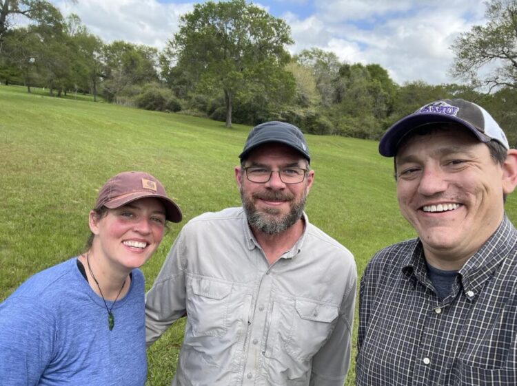
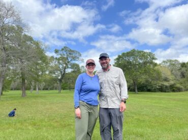
The archaeologists
In the spring of 2006, Dr. Walker founded Archaeo-Geophysical Associates, LLC, an archaeological consulting firm specializing in geophysical prospection. Since that time, he has collected geophysical data on over 150 archaeological sites, now totaling much more than 1,539 Acres of Gradiometer, 115 Acres of Ground-Penetrating Radar, and 484 Acres of Electromagnetic Induction Meter.
Aundrea Thompson studied at the University of Wyoming, and she has worked as a forensic archaeologist on numerous projects in the past ten years. For more on one project, in which she located the remains of a World War II soldier and brought his remains back to the US for burial, please click HERE
Hauling their geophysical prospection equipment in a large pick-up truck around the country, Aundrea and Chet spent almost a week on campus conducting the cemetery surveys.
Not only did they push the ground-penetrating radar over the entire five acre field to determine the size of the burial ground, but they also used a drone to scan a 120 square mile area with LIDAR. Moreover, they pulled a magnetometer across the five-acre field to compile additional data.
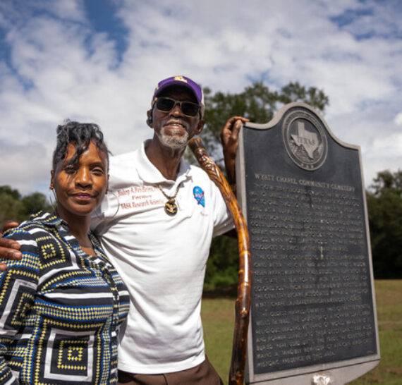
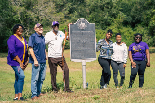
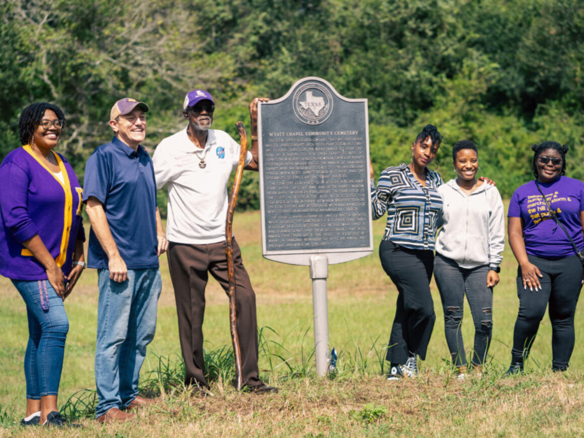
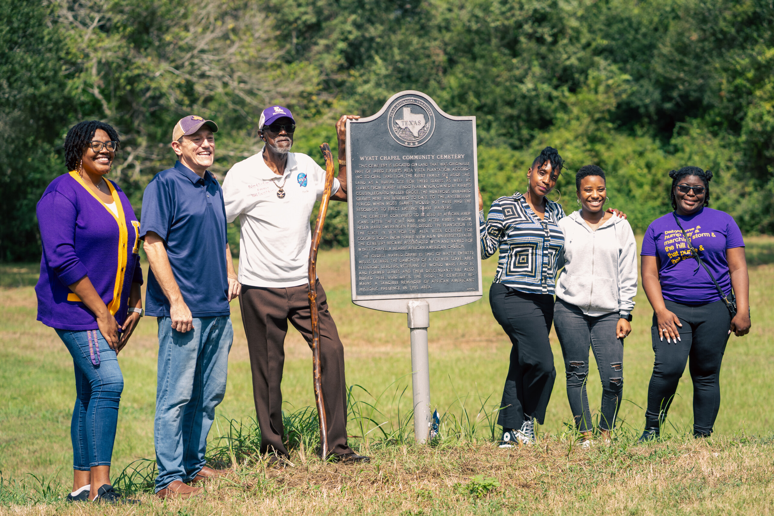
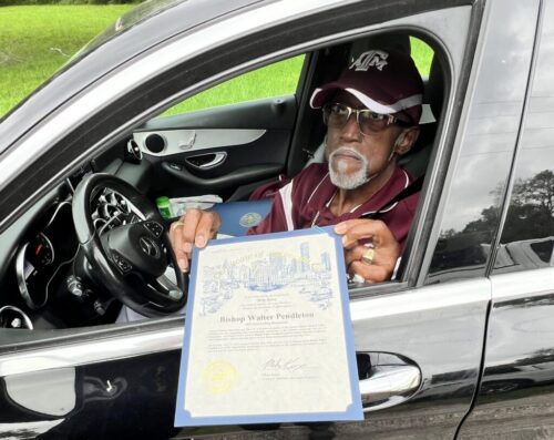
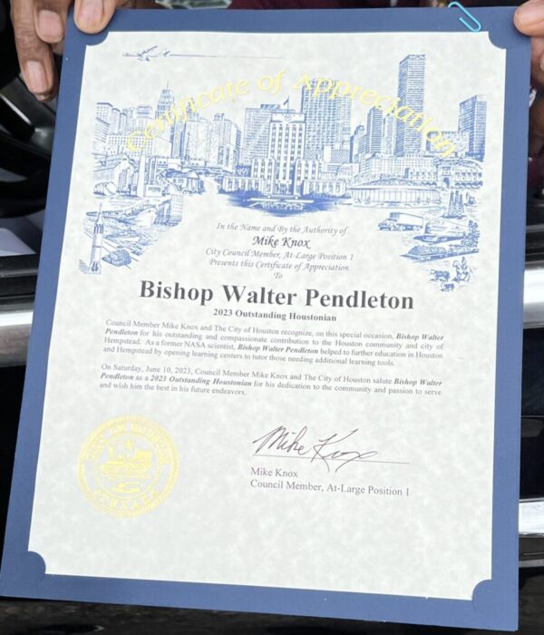
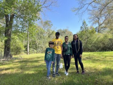
Bishop Pendleton is a descendant of one of the individuals buried in the cemetery. He visited his ancestral burial ground during the magnetometer study.
Rev. Pendleton shared some information about his ancestry with us at the cemetery. We plan to conduct interviews with him and several other descendants as the next stage of the project.
The cemetery
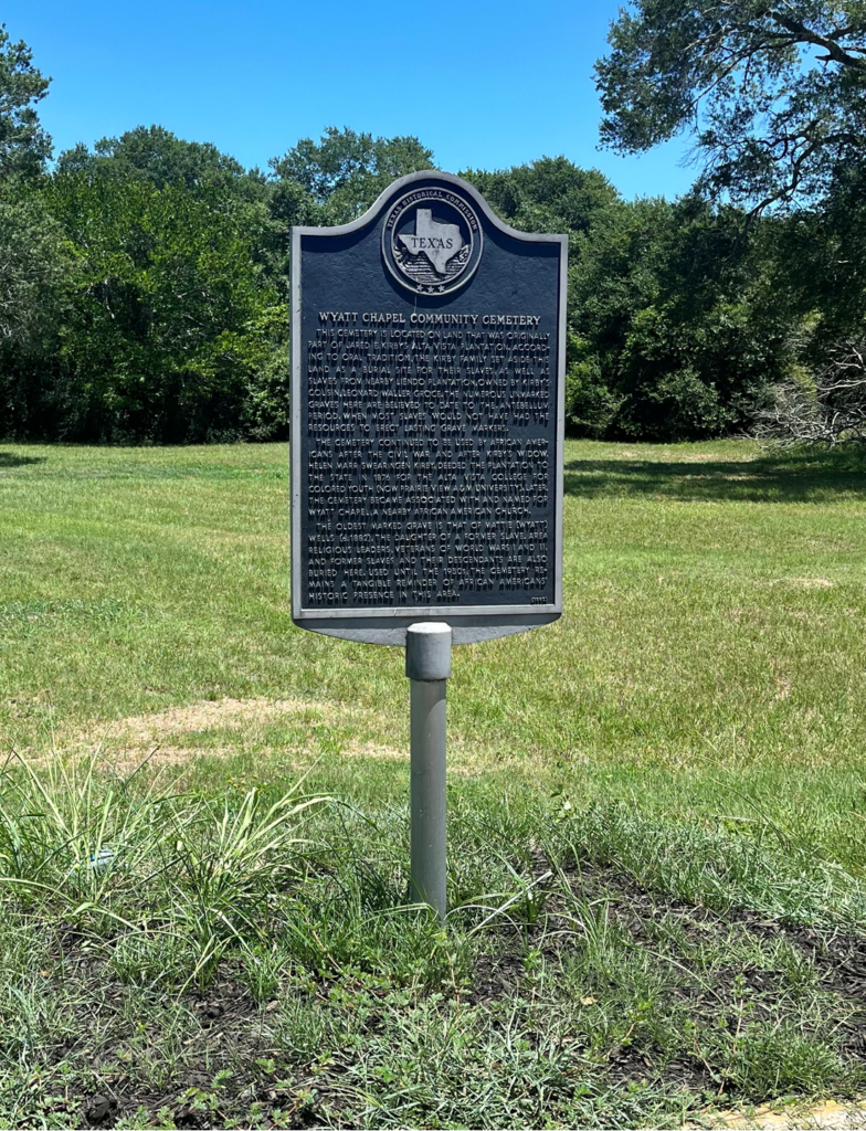
The burial ground is associated with and named after an African American church founded in the 1890s by Reverend George W. Wyatt, a one-time school teacher and politician who represented Waller and Fort Bend Counties in the state legislature in the 1880s. Based on slave schedules, Wyatt Chapel Community Cemetery might contain hundreds of graves of enslaved people, formerly enslaved people, and their descendants. It sits on the former slave labor plantation of Jared E. Kirby, who, in 1860, owned more enslaved people (159) than any other planter in Austin County. No one made a formal record of these burials, however, and the historic burial ground, which is located behind University Village Phase III, was over time abandoned, especially after 1961, with the establishment of nearby Prairie View Memorial Gardens. Wyatt Chapel Community Cemetery contains only a handful of marked graves, but it holds forever close the remains of three United States military veterans.
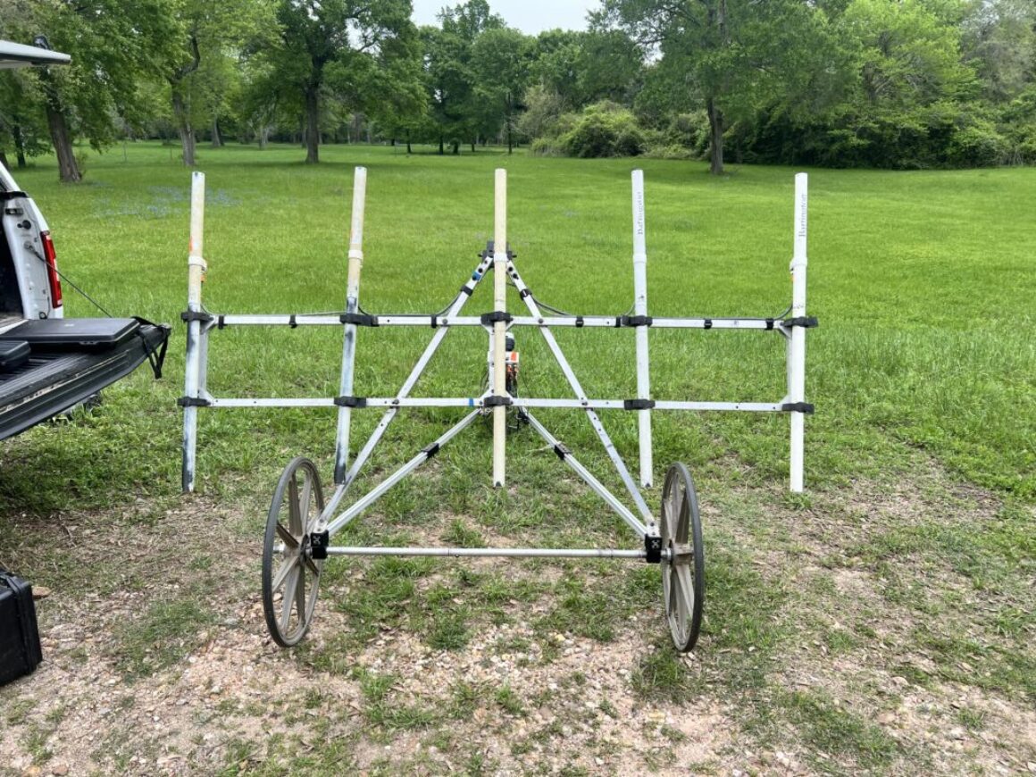
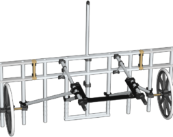
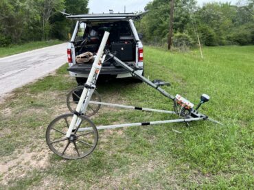
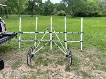
Chet pulls a large magnetic gradiometer behind him. It’s a passive instrument that measures changes in the Earth’s magnetic field.
Magnetic Gradiometer
Chet and Aundrea have a large magnetic gradiometer, a passive instrument that measures changes in the Earth’s magnetic field.
Chet and Aundrea completed the data collection with the magnetometer. Now that all the data is collected, they will analyze the data from the GPR, LIDAR, and magnetometer and submit their findings to Dr. Nesta Anderson, of Legacy Cultural Resources, Inc., who will meet with Dr. Moore and Pamela Morgan, of the Wyatt Chapel Descendants Committee, to compare the results to the findings from the pedestrian survey.
Digital PV Panther Project John B. Coleman Library Room 111 Prairie View, Texas 77446
On March 12 and 13, 2024, Legacy Cultural Resources, Inc. invited ground penetrating radar specialists Dr. Chet Walker and Aundrea Thompson to visit the campus of Prairie View A&M University (PVAMU) and conduct several geophysical examinations of the historic burial ground of Wyatt Chapel Community Cemetery.
This project is funded through the Summerlee Foundation.
Aundrea Thompson, Dr. Chet Walker, and Dr. DeWayne Moore
Aundrea Thompson & Dr. Chet Walker met with project director and PVAMU Assistant Professor of History DeWayne Moore to learn more about the grant from the Summerlee Foundation.
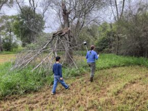
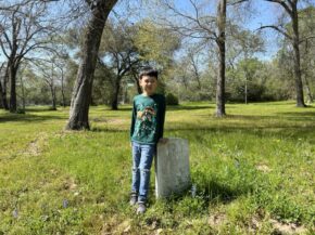
Dr. Moore’s son, Noah, surveys the cemetery with students workers on the Digital PV Panther Project–Noah Jackson, Zynitra Durham, and Jaylynn Brantley
The archaeologists
In the spring of 2006, Dr. Walker founded Archaeo-Geophysical Associates, LLC, an archaeological consulting firm specializing in geophysical prospection. Since that time, he has collected geophysical data on over 150 archaeological sites, now totaling much more than 1,539 Acres of Gradiometer, 115 Acres of Ground-Penetrating Radar, and 484 Acres of Electromagnetic Induction Meter.
Aundrea Thompson studied at the University of Wyoming, and she has worked as a forensic archaeologist on numerous projects in the past ten years. For more on one project, in which she located the remains of a World War II soldier and brought his remains back to the US for burial, please click HERE
Hauling their geophysical prospection equipment in a large pick-up truck from Palestine, Texas, where they had been working at another archaeological site, Aundrea and Chet planned to spend two days on campus before driving to Magnolia, Texas to collaborate with the Houston Archaeological Society on a dig site.
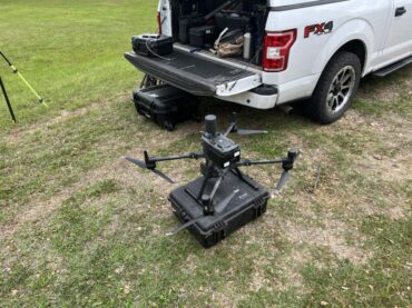
At PVAMU, Chet and Aundrea planned to run the ground-penetrating radar over the entire five acre field to determine the size of the burial ground. In addition, they intended to scan the field with an electromagnetic induction meter as well as LIDAR [or Light Detection and Ranging], which is attached to a large drone and scans an estimated 120 acre area.
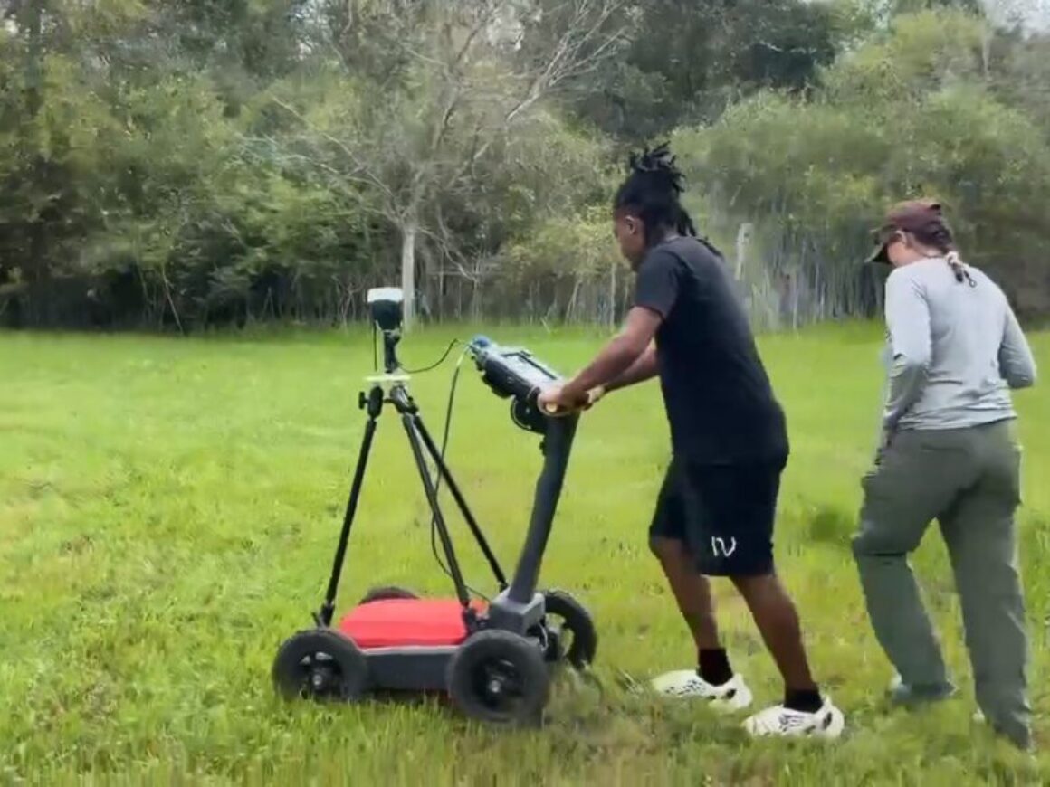
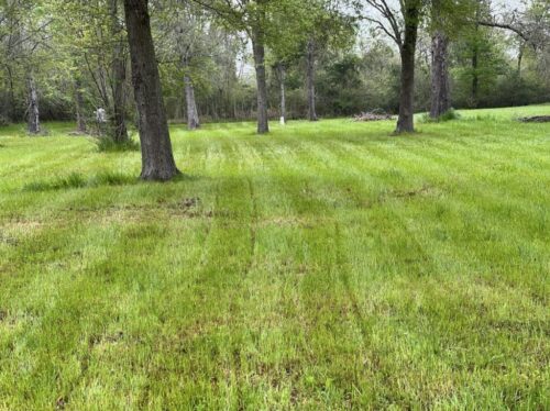
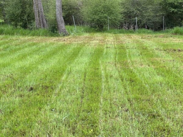
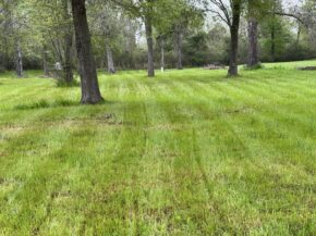
In this image, you can see how running the GPR looks on the grass. Making an imprint similar to that of a lawn mower, Chet and Aundrea covered the entire field, hoping to determine the size of the burial ground.
By scanning the entire field, the teams intends to use the data from GPR to corroborate data obtained during the pedestrian survey in October 2023. We hope to determine the locations of graves and the size of the burial ground.
The cemetery
The burial ground is associated with and named after an African American church founded in the 1890s by Reverend George W. Wyatt, a one-time school teacher and politician who represented Waller and Fort Bend Counties in the state legislature in the 1880s. Based on slave schedules, Wyatt Chapel Community Cemetery might contain hundreds of graves of enslaved people, formerly enslaved people, and their descendants. It sits on the former slave labor plantation of Jared E. Kirby, who, in 1860, owned more enslaved people (159) than any other planter in Austin County. No one made a formal record of these burials, however, and the historic burial ground, which is located behind University Village Phase III, was over time abandoned, especially after 1961, with the establishment of nearby Prairie View Memorial Gardens. Wyatt Chapel Community Cemetery contains only a handful of marked graves, but it holds forever close the remains of three United States military veterans.
LIDAR, which stands for Light Detection and Ranging, is a remote sensing method that uses light in the form of a pulsed laser to measure ranges (variable distances) to the Earth.
Drone with LIDAR
Chet and Aundrea have several drones that can carry up to 22 pounds of equipment.
Pre-Set Navigation
With pre-set navigational controls, the drone flies back and forth in straight lines, capturing data about the contours of the earth over a 120 square mile area.
Chet and Aundrea completed the data collection using ground penetrating radar for the entire five acre field, and they obtained LIDAR data using the drone, but they plan to return later in March 2024 to complete data collection with the magnetometer. Once all the data is collected, they will analyze their findings independently and objectively, and they will submit their findings to Dr. Nesta Anderson, of Legacy Cultural Resources, Inc., who will meet with Dr. Moore and Pamela Morgan, of the Wyatt Chapel Descendants Committee, to compare the results to the findings from the pedestrian survey.
Digital PV Panther Project John B. Coleman Library Room 111 Prairie View, Texas 77446
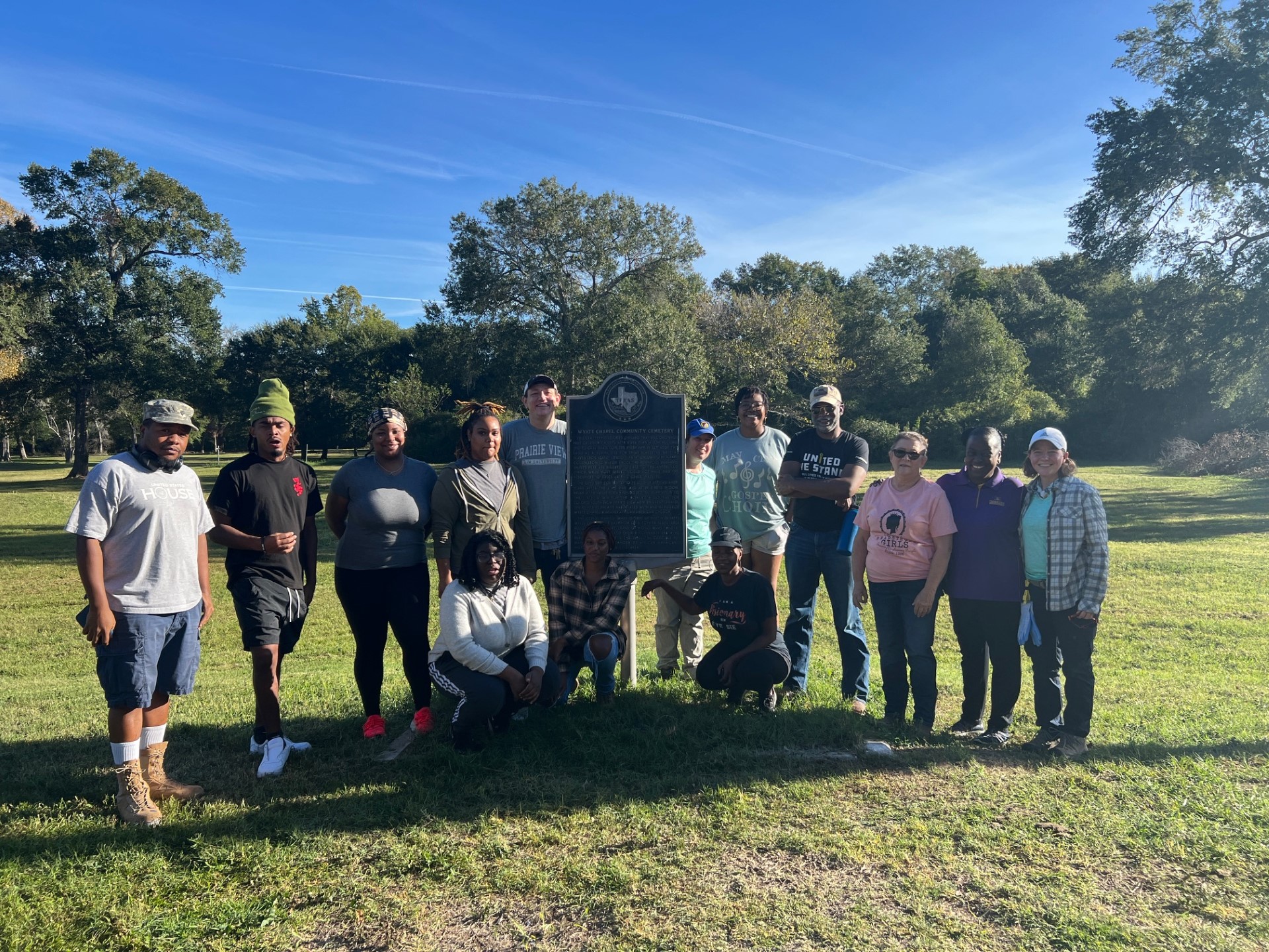
On October 21, we met with the Legacy Cultural Resources, Inc. team at the Wyatt Chapel Community Cemetery. We began the second phase of the cemetery study, where we conducted the Archaeological Pedestrian Survey.
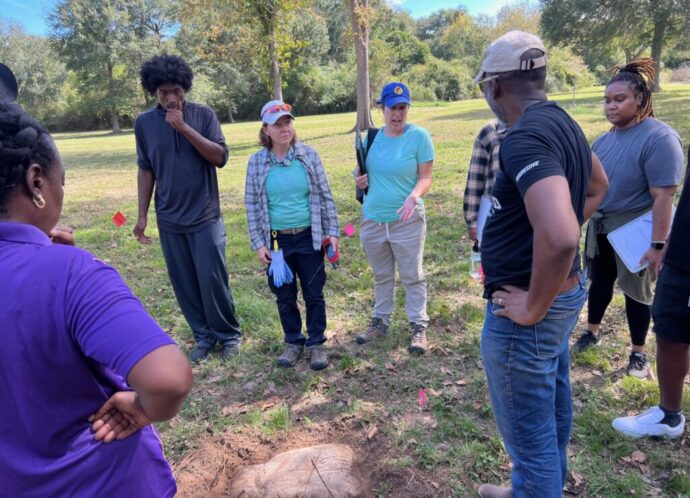
The archaeologists led a team of student volunteers in an intensive pedestrian survey of the project area. We anticipated to cover 3-5 acres in size. Archaeologists worked with small groups of students, teaching them basic pedestrian survey techniques. After the pastor of the Wyatt Chapel Baptist Church prayed and blessed the team, the survey began.
As we marked and mapped out the gravesite, the archaeologists also worked with the students to record the Wyatt Chapel Community Cemetery as an archaeological site. This will provide it with a state-registered trinomial. Students worked with archaeologists to record the burial ground in the field on a TexSite form. We plan to submit and contact the Texas Archeological Research Laboratory (TARL) in Austin to obtain the trinomial.
The small groups walked the project area in transects spaced 30 meters (m) apart, looking for evidence of grave markers, grave tending artifacts, depressions, or other potential indicators of the presence of burials. After we marked these features with pin flags, the archaeologists taught participants how to map the burial site with a handheld Trimble GPS unit. Since we hoped to disturb the burial ground as little as possible, we did not collect any artifacts as part of the pedestrian survey. Instead, we photographed grave marker and grave tending artifacts in the field.
There were a few surprising finds during the survey. We were shocked to realize how large the gravesite was compared to the estimations. Students marked off graves along most of the fence lines. We also found grave tending materials around a tree closer to the front of the walking path than expected.
We also learned a new technique for determining burial spots. Using the pin flags, we were told to push them into the ground in areas we believed marked a grave. If the pin flag was restricted from going too far into the ground, that was used as a point of interest to where someone may have been buried. Using this method, we found areas in the cemetery where there appeared to be parallel rows of burials. This method also helped us find possible burial sites near a group of 3 trees. At these trees, students also found a large cluster of grave tending materials and grave borders, which tends to signify a family was buried there.
Based on reports in the early 2000s, this gravesite was unknowingly being used as a dumping ground. Once this was found out, the powers that be had the trash moved. However, the trash was bulldozed further back and to the right onto that land and fenced in. As we worked on the Pedestrian Survey, we could get a whiff of the trash behind the fence as we got closer to the fence or if the wind blew. The pastor of Wyatt Chapel Baptist Church and others from the community believe that cemetery extends to where the trash now sits.
Towards the end of the survey, Nesta Anderson and Melanie Nichols–of Legacy Cultural Resources, Inc–went over the fence and performed an examination of the trash pile. We plan to report our findings to the Texas Historical Commission, which will offer guidance on the removal of the trash. In doing this, it will help us to get written authorization from the THC to remove the garbage and survey that land as well.
The Digital PV Panther Project looks forward to receiving feedback from both Legacy Cultural Resources and the Texas Historical Commission in 2024!
Our mission at the Digital PV Panther Project is to eliminate historical silences through digital storytelling and prevent the erasure of African American history through historic preservation at PVAMU.
Within my first week as an archival assistant working on the Digital PV Panther Project, I learned a great deal about the rich history of Prairie View A&M University (PVAMU). My first task was to sort out tape recordings from different events that took place on and around campus. Many of the events took place around the early 1960s to the late 1980s. Events included, summer and spring convocations, dance recitals, ministry conventions, homecoming parades, sports banquets, and athletic games just to name a few. Each tape recording contained the speeches of Former PVAMU President Dr. A.I. Thomas, PVAMU professors, and special guests and speakers, such as Jesse Jackson and Rosa Parks. If you’re wondering, yes the tapes are still in good condition and are playable.
My journey into the archival collections at PVAMU continued at Wyatt Chapel Community Cemetery on the back side of campus. For those who may not know, PVAMU was built on top of Jared Ellison Kirby’s former enslaved labor camp, Alta Vista, and he set aside a small plot of land for a burial site for the enslaved. The cemetery behind dormitories “Phase 3 & 6.” The burial ground contains six headstones of the deceased, while the rest of the cemetery holds the unmarked graves of our ancestors. In the upcoming fall 2022 semester, PVAMU Assistant Professor of History Dr. DeWayne Moore and Special Collections Librarian Lisa Stafford will hire an archaeological firm to conduct a ground penetrating radar study of the cemetery. You can read more about the study HERE. The ground penetrating radar will scan the burial ground to determine the location of grave shafts. Using this technology, we will finally be able to determine the burial locations of our ancestors and other internments in the cemetery.
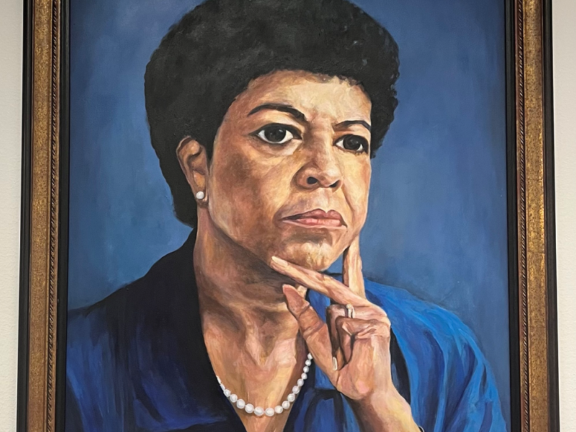
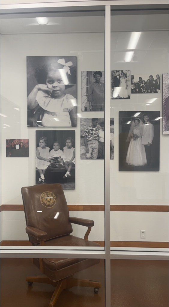
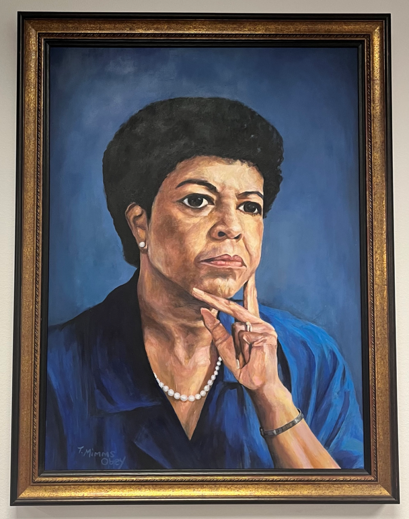
After exploring Wyatt Chapel Community Cemetery, I visited the fourth floor of the library and learned more about the history of Wilhelmina R. Delco. Born in Chicago, Illinois on July 1, 1929, Ms. Delco was an active student. She served as student body president and member of the National Honor Society. She obtained her Bachelors of Art degree from Fisk University in Nashville, Tennessee. She majored in Sociology and minored in Economics and Business Administration. Moreover, Ms. Delco served in the Texas House of Representatives. She began her career in 1974, when she was elected the first black, female, African American official from Travis County. She was sworn into office January 1975 and she began serving her very first term during the 64th legislative session.
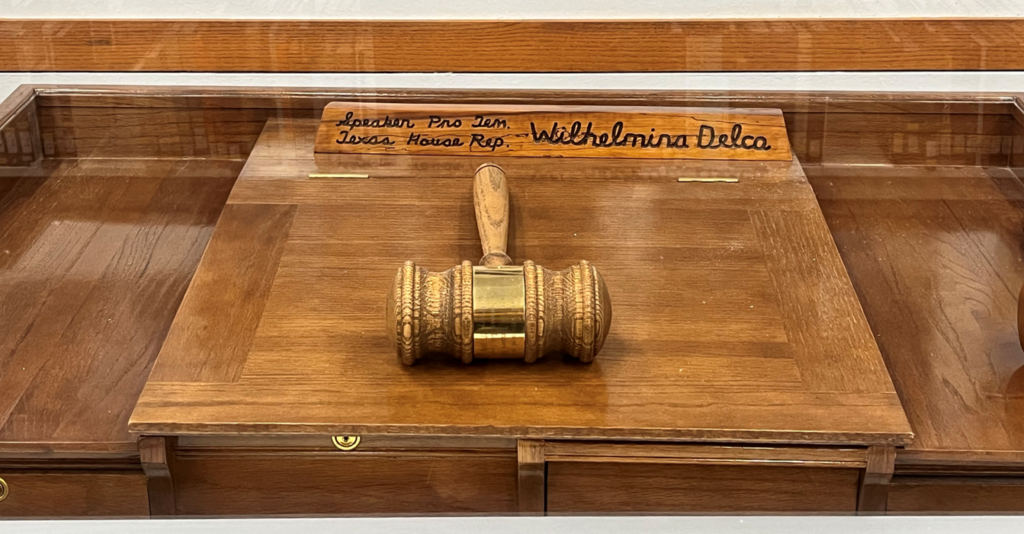
She worked with the community and state on numerous social, educational, and political issues. Her most notable work was done in the area of Education. In 1979, Ms. Delco was appointed Chair of the House Higher Education Committee, on which she served until her next appointment as Speaker Pro Tempore in 1991. In January 1995, she retired from her tenth term and twentieth year in the Texas House of Representatives.
Ms. Delco received many awards, honors, and recognitions throughout her career–two of them being here at PVAMU. The Wilhelmina R. Delco building is home to the Whitlowe R. Green College of Education. Along with an unprocessed manuscript collection of papers, which sits in the PVAMU Archives, the John B. Coleman Library curated an exhibit about her life and career on the 4th floor. It contains an enclosed display of personal pictures, letters, documents, and other media that Ms. Delco used during her time as a representative. These items are up for display, open to staff, students, and the public.
Between the work of Wilhelmina Delco and the acknowledgment of the Wyatt Chapel Community Cemetery, I have became deeply involved in historic preservation at my HBCU. There is a lot of history that has yet to be uncovered. I cannot wait to see what the rest of the year has in store for the Digital PV Panther Project. And remember, PVAMU is the place to be!
My experience working on the Digital PV Panther Project started off on a high note. In my first week, I uncovered some long-lost elements of university history that stretch back almost two centuries on a field trip to the Austin County Courthouse archives in the town of Bellville, TX. I also tried the chicken tenders at Dairy Queen for the first time! Most importantly, however, I sparked an intense curiosity within myself about the rich history and campus geography at Prairie View A&M University (PVAMU).1
I started the week conducting research on several professors who made marvelous strides in building the prestige of our university. I searched the Digital Commons using bepress, our digital content management system, for past issues of the student newspaper, The Prairie View Panther, and I compiled scores of article excerpts into a single document to help prepare biographies for the new finding aids being created with funding from the Texas State Library & Archives Commission.
One of the professors I researched was Raymond Carreathers, who served as a guidance counselor in the College of Arts and Sciences. In the 1970s, he also served as head of resident and student life in Alexander Hall, a male freshman dorm. He was also a member of the ETA GAMMA chapter of Alpha Phi Alpha Fraternity, Inc. Moreover, he served as an advising officer to the Pan-Hellenic Council as well as the Vice-President of the Southwest Region of Alpha chapters.
The second professor on my list was Carrie B. Coss, a professor of education who joined the faculty in 1946. Formerly at Langston University, she earned bachelor’s degrees from Howard University and Cincinnati University, and she received her master’s degree from Columbia University in New York. Coss also served as a committee chairperson for the Alpha Mu Gamma Honors Society. Not only was she a professor of education at PVAMU, but she was also local historian who uncovered hidden histories on campus. In 1989, Coss worked with the Waller County Historical Society to document African American cemeteries, and she also served on the historical marker committee for Wyatt Chapel Community Cemetery, which sits RIGHT BEHIND campus, about a 3-minute walk from Phases 3 & 6. For more information on this committee, please see a previous blog post (Click HERE)
I also compiled lists of articles about Colquitt Dubois Yancy, Florida Yeldell, and Mrs. John C. Winfree–just to name a few, but you will have to wait until a later post or for us to finish the new finding aids in August 2022.
I also learned a great deal of new information about the history of PVAMU. Not only was the information new to me, but some of it is also a completely new discovery for everyone. The original name of the enslaved labor camp on which PVAMU now sits was called Alta Vista, and it was once owned by Colonel Jared Ellison Kirby. Born in Georgia in 1809, he moved to Texas and amassed a large estate, which he sought to protect through service to the Confederacy. He was shot and killed in October 1865 by a Union supporter in Galveston, Texas. His wife, Helen, acquired Alta Vista upon his death, and she sold it to the State of Texas in the mid-1870s to establish the Alta Vista Agricultural & Mechanical College for Colored Youths, which later became what we know today as PVAMU.
Everyone reading this blog post most likely knows that the state legislature decided to establish PVAMU in Waller county in 1876. You probably did not know, however, that the state legislature passed the act that established Waller County in 1873. Kirby’s enslaved labor camp at Alta Vista, therefore, was located in another county prior to 1873. If I wanted to know anything about Alta Vista prior to the Civil War, I had to visit the county seat of Austin County and find documents related to Kirby and his kin. I wanted to find out what happened on our campus before it was “our” campus. So my boss, Dr. DeWayne Moore, took me to the Bellville Texas Justice Center, which had records about Kirby and many other families.
I had never been to Bellville, but it was a very interesting little town, and I posted some pictures from our visit to the city.
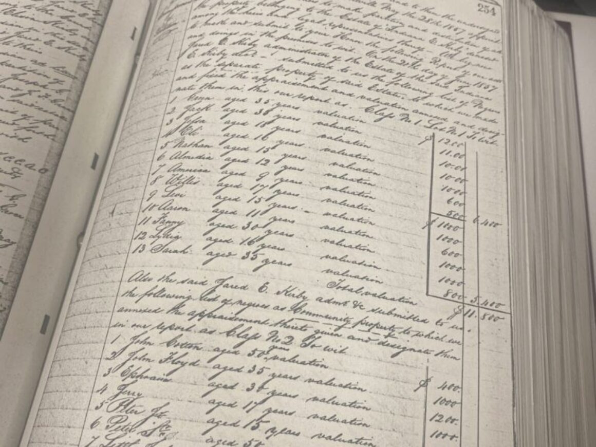
Once we got to the justice center on North Chesley Street, we found our way to the records room–a massive archive full of deed, marriage, and probate records in heavy, leather-bound books that recorded the history of Austin County all the way back to the time of the Texas Revolution. In one of those books, we located the probate record of Jared Ellison Kirby, the planter who owned the enslaved labor camp, Alta Vista, at the time of the Civil War. As I mentioned earlier, Kirby died only a few months after emancipation in October 1865, and his probate contains information about all the property he owned at the time of his death. We hope his probate will contain information about his involvement in slavery, but it will take more time to transcribe its almost 200 pages.
Please do not step on the grass!
The central purpose of our trip to Bellville was to discover our lineage. What existed on campus before it was PVAMU? Who lived on this ground before students? And what is the story of our campus before it was sold to the state to become a university? One tradition at PVAMU, which many students know before they ever set foot on campus, is never stepping on the grass. To pay respects to our enslaved ancestors who lie buried in unmarked graves, we do not step on the grass. We keep off the grass to honor our ancestors who might be buried in any plot of this hallowed ground.
We do not know the exact location of their graves, and we do not know the names of our ancestors, because slave owners did not bother to record the names of the enslaved in the US Census–only their age and gender.
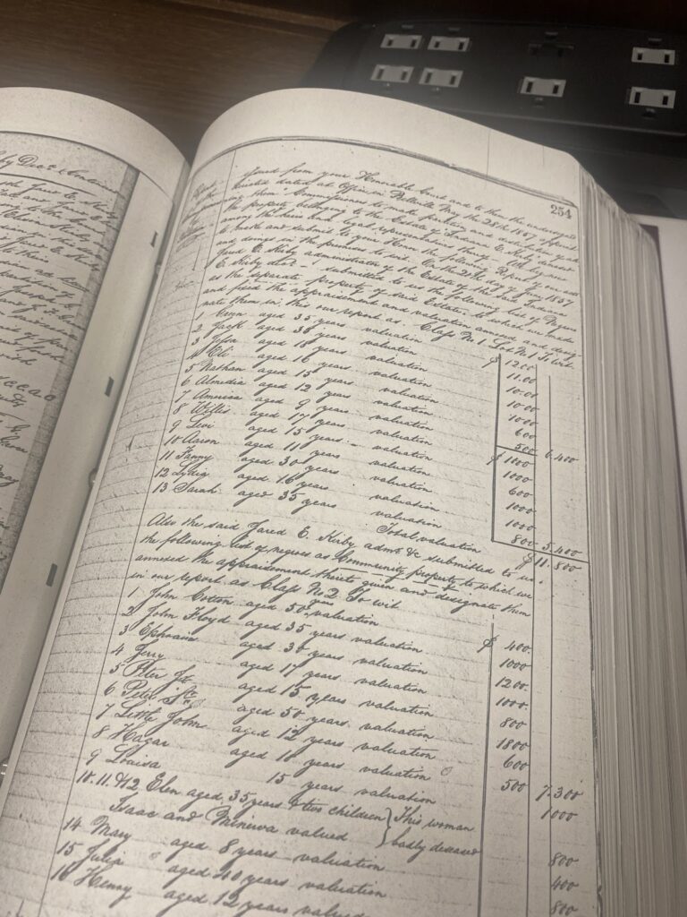
In Bellville, we made one of the most significant historical discoveries in the history of PVAMU. We discovered the names of 58 individuals who once were enslaved at Alta Visa.
Due to the fact that the probate is written in old 1800s English cursive handwriting, you may not be able to read this, but I can list a few names for you.
“Willis 17 years old worth 1000 dollars, Levi 15 years old worth 1000 dollars, Sarah 35 years old 800 dollars and Almedia 12 years old 600 dollars.”
While not in this picture, the youngest enslaved person that I’ve seen was a 2-year-old girl named Ellen, who was “worth” 300 dollars. This sight, honestly, was very surreal.
It is one thing to watch Hollywood movies about the Civil War, and it is one thing to learn about slavery in college history courses, but it is quite another to see the names of human property written down in a way that you would write a receipt or account balance sheet. It’s quite surreal to see the listed names of Black people–BLACK CHILDREN–and how old they were and their monetary value, like a material item, we might buy or sell today.
In 1860, 40-year old Jared Ellison Kirby owned 285,000 in real estate and $175,000 in his personal estate, and he lived at Alta Vista with his 23-year old wife, Helen, his two children, 12 year old Lucy and 7 year old Jared Jr. The 73-year-old mother of Jared Kirby was named Sarah, and she owned $32,000 in real estate and $32,000 in personal property. She also lived at Alta Vista.1
The 1860 Slaves Schedules reveal that Jared Kirby owned 30 slave cabins on his property. According to an article in the Prairie View Panther, the slave cabins at Alta Vista were located where the Hobart Taylor building now sits.2 His mother owned 10 slave cabins, in which lived the 19 slaves she owned in 1860.
Jared owned 5 forty-two year old male slaves, 30 thirty-year old male slaves, 21 fifteen year old male slaves, and 15 five year old male slaves. He also owned 4 forty two year old female slaves, 17 twenty five year old female slaves, 22 fifteen year old female slaves, and 25 six year old female slaves.3
71 men, and 68 women. Total of 139 listed under Jared’s name. If you add the 19 people listed under Sarah’s name, that means 158 enslaved men and women lived at Alta Vista in 1860.
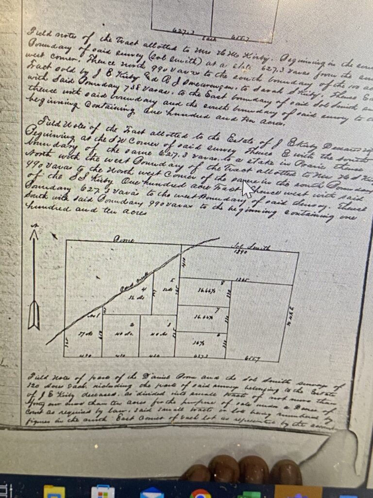
In total, we managed to find almost 60 names of our enslaved ancestors in the probates of Jared Kirby’s family members. We were also able to find a map of the enslaved labor camp, Alta Vista, (see above image) which is only part of the campus we know today. We look forward to revealing more information from the probate records in future posts for the Digital PV Panther Project.’
Sincerely,
Kalayah Jammer
END NOTES
1860 USCensus, Hempstead, Austin, Texas; Roll: M653_1287; Page: 175; Family History Library Film: 805287
Gregory Bevels, “Gone but not Forgotten ~ Reflections on Wyatt Chapel Cemetery,” Prairie View (TX) Panther, October 21, 1994.
The National Archives in Washington DC; Washington DC, USA; Eighth Census of the United States 1860; Series Number: M653; Record Group: Records of the Bureau of the Census; Record Group Number: 29
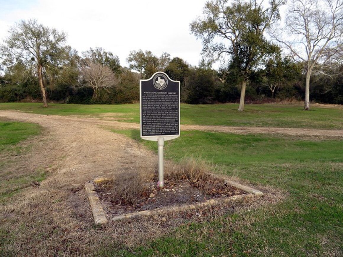
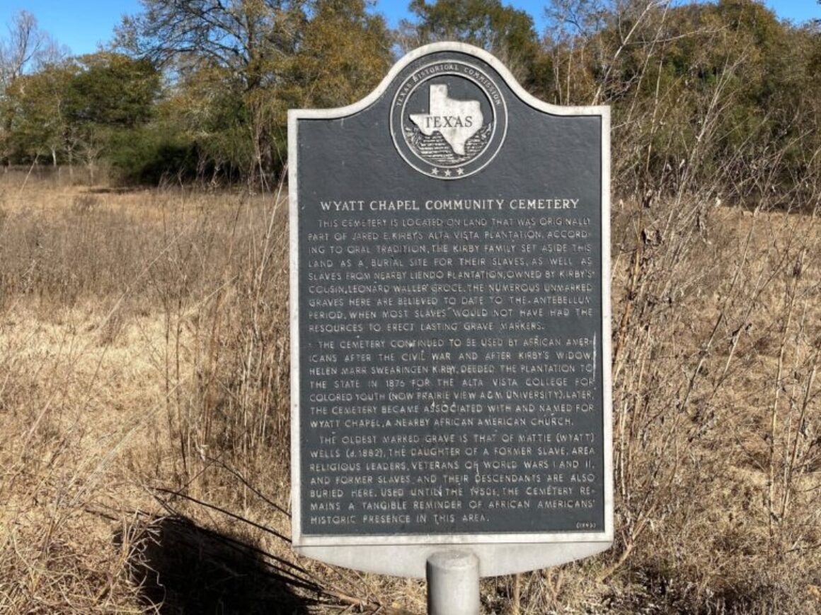
In the summer of 1989, Dr. Mildred W. Abshier and a research team consisting of Bessie Thomas, Frank Jackson, and Carrie B. Coss visited the cemetery with 82 year-old descendant Ida Lou Wells Owens Pierce, a longtime resident of the Wyatt Chapel community. Using the field research, local scholarship, and the information gleaned from several interviews, Dr. Abshier prepared the following report to accompany the historical marker application submitted to the Texas Historical Commission. Their efforts resulted in the dedication of a historical marker near the cemetery behind Prairie View A&M University in 1992. We located this report while preparing the grant proposal to the Summerlee Foundation in 2021, and we decided to publish it below in advance of the ground penetrating radar survey in September 2022.
Wyatt Chapel Community Cemetery, an abandoned all-black burial ground, is located on the north side of Prairie View A & M University campus, the Jesse Clary Survey, Abstract 111, Waller County Texas.1 Exact location of the cemetery with reference to the enclosed map and the Prairie View A & M Campus was attested by tax office personnel of Waller Independent School District, Waller, Texas, in which district the cemetery and the university are located.2
The burial site is a portion of the Jared E. Kirby plantation which the state of Texas purchased in 1876 from Mrs. Helen Marr Swearingen Kirby, widow of Jared E. Kirby, for the purpose of establishing the “Agricultural and Mechanical College for Colored Youth.”3 Size of the burial place is not definitely known, but is believed by various residents of the Prairie View area to consist of about five acres, more or less.4
The burial place is bounded on the west by old Farm Road 1098 by which a north entry is made to the campus, on the south by Flukinger Road, and on the northeast by Pond Creek, with Farm Road 1488 paralleling the creek, in general at a distance of some one-eighth mile.
Just when the cemetery began to be used is not known. However, the Kirby mansion at Alta Vista is believed to have been built at some time between 1858 and 1861, and Kirby is reported to have owned some four hundred slaves.5 Since the beginning date of the cemetery is lost in the haze of time and the lack of records, Dr. George Woolfolk, Chairman of the History Department at Prairie View A&M University, Emeritus, said, “It is feasible to believe that what is now known as Wyatt Chapel Community Cemetery was in the beginning simply the burial place for the Kirby slaves and other black people of the community.”6
Worthy of noting is the fact that when Waller County Historical Commission surveyed the County to obtain information for publishing a county cemetery directory (Published in 1977), Mrs. Carrie B. Coss, of Prairie View, gathered the needed information for black cemeteries.7 She was advised by several elderly persons of the Prairie View area that slaves from nearby Liendo plantation were buried in the cemetery in question. Interestingly, Jared E. Kirby, owner of [enslaved labor camp] Alta Vista, which was to become Prairie View A&M University campus, and Leonard Waller Groce, owner of Liendo plantation, were cousins and their plantations were in close proximity. The present owner of Liendo has indicated that he did not know where the Liendo slaves were buried.8 No one, other than those whom Mrs. Coss interviewed (Coss note), was able to point to a spot where the Liendo slaves were interred.
On June 22, 1989 researchers (Mrs. Bessie Thomas, Mr. Frank Jackson, Mrs. Carrie Coss, and Dr. Mildred W. Abshier) visited the abandoned burial site. Mrs. Ida Lou Wells Owens Pierce, age eighty-two, a Wyatt descendant and long time resident of the Wyatt Chapel/Prairie View area, accompanied the researchers.
Abandoned since the early 1950s (The latest death date available from head stones was 1953.),the cemetery was quite overgrown, covered with dense growth of underbrush and shrubs. A few large trees stood among the under growth and this would seem to indicate that once the place had been kept cleared of all but a few trees. Professor Howard Jones, History Department of Prairie View A&M University, with students from the University, had cut a pathway through the underbrush to a portion of the burial ground where markers – generally slab-type head-stones, some of which were broken and/or overgrown with lichens – were yet standing, however some were broken and lying on the ground. Researchers were able to record names and dates on those visible markers (See list below). On every side there were numerous depressions in the soil which indicated the presence of unmarked graves. Of these, Mrs. Pierce said that they were indeed old grave sites. She further said that Caroline (See list) was her grandmother and that she had been a slave. She believed that many slaves, or those formerly held in slavery, were buried at the site. She pointed to a grave within a wire enclosure and noted that was the grave of her mother, Mrs. Mattie Wyatt Wells. Although not attested by markers, Mrs. Pierce indicated that numerous members of the Wyatt and Owens families, as well as other black persons, were buried at the site. She also said that an uncle of hers who was a minister had established the Wyatt Chapel Church which is a mile, or more, from the cemetery.
The consensus of opinion of the elderly ones who live in the area is that the Wyatt Chapel Community Cemetery was abandoned when a more easily accessible burial place became available in the nearby Hempstead area. From dates on stones observed and recorded the site appears to have been abandoned in the early 1950s, as the latest death date found was 1953.
In conclusion, it appears most likely that the cemetery was originally the burial place of Kirby slaves, probably also slaves from nearby Liendo Plantation. After Emancipation it continued as a burial place for black persons of the area until the 1950s.
Headstone Recordings in Wyatt Chapel Community Cemetery
James Duckworth Nov. 19, 1909 Died Sept. 3, 1949
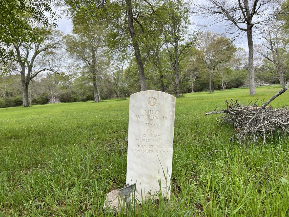
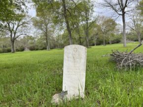
Milo Wilson, Jr. Tex. Pvt. U.S. Army WWI July 22, 1892-Nov. 8, 1953
Albert Collings Died July 5, 1922 Gone but not forgotten OLD PAP
Mrs. Mattie Wyatt Died 8-17-82
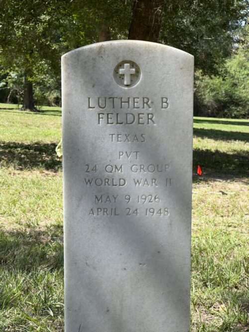
Luther B. Felder Tex. Pvt. 24th QM Group, WWII May 9, 1926 – Apr. 24, 1948
Theodore Anderson JUNETH 5 (handmade marker)
Elsie Bailey Texas Pvt. QM Corps, WWI March 31, 1892 – May 19, 1948
Memory of Caroline Wife of (stone broken) Died June 24, 1898
End Notes
1. “Map of Cemetery Area” from the District Tax Appraisal Office, Katy, Texas.
2. Stanley Holt, Assistant Superintendent for Finance, the Tax Office, Waller Independent School District, Waller, TX, November 6, 1989.
3. A History of Waller County, Texas (Hempstead, TX: Waller County Historical Survey Committee, 1973), 263.
4. Notes by Bessie Thomas, Prairie View, TX.
5. George R. Woolfolk, “Alta Vista: A Monument of Sorrow,” One Hundred One Heritage Homes of Waller County, Texas (Hempstead, TX: Waller County Historical Society, 1976), 257.
6. Interview with Dr. George R. Woolfolk, Prairie View, TX, August 1, 1989.
7. Notes by Mrs. Carrie B. Coss, September 18, 1989 – “While surveying Waller County to determine the location of the black cemeteries in this area several old citizens in the Prairie View community, all of whom are now deceased, were contacted by me I was told by these people that the cemetery on the back road from Prairie View (now referred to as the Wyatt Chapel Community Cemetery) was the burial place of slaves from Liendo Plantation.”
8. Interview with Carl Detering, of Houston, at Liendo, October, 1989.
It is when you give of yourself that you truly give
What We Care
Child Education
Duis aute irure dolor in reprehenderit in voluptate velit esse cillum dolore eu fugiat nulla pariatur. Excepteur sint occaecat cupidatat non proident, sunt in culpa qui officia deserunt mollit anim id est laborum.
At vero eos et accusamus et iusto odio dignissimos ducimus qui blanditiis praesentium voluptatum deleniti atque corrupti quos dolores et quas molestias excepturi sint occaecati cupiditate non provident.
Nam libero tempore, cum soluta nobis est eligendi optio cumque nihil impedit quo minus id quod maxime placeat facere possimus, omnis voluptas assumenda est, omnis dolor repellendus.
Lorem ipsum dolor sit amet, consectetur adipiscing elit, sed do eiusmod tempor incididunt ut labore et dolore magna aliqua. Ut enim ad minim veniam, quis nostrud exercitation ullamco laboris nisi ut aliquip ex ea commodo consequat. Duis aute irure dolor in reprehenderit in voluptate velit esse cillum dolore eu fugiat nulla pariatur. Excepteur sint occaecat cupidatat non proident, sunt in culpa qui officia deserunt mollit anim id est laborum.
By Alison T. Henning, Ginger Burns, Richard Hoffman, and Brian Jacoby in the Journal of History and Culture 1:2 (2009): 53-66.
Abstract
Wyatt Chapel Cemetery is an abandoned cemetery located in Prairie View, Texas. Oral histories from local residents suggest that the cemetery originated as a slave burial ground in the mid-nineteenth century. The local community is interested in examining the cemetery in order to document the history of the area. In July 2007 and February 2008, participants in a graduate course at Rice University acquired global positioning system and ground-penetrating radar data at the cemetery. The soil at the field site is ideally suited for radar work and the subsurface image quality was excellent. Numerous anomalies were identified that are consistent with unmarked burials. Two of these anomalies were excavated and confirmed as burials. The stratigraphy consists of 3-6 feet of sand overlying a hard clay, and the boundary produces a very bright reflector. In the main clearing of the cemetery site, the sand-clay boundary deepens abruptly from 3 feet to approximately 5 feet. This anomaly was initially considered a possible man-made excavation, perhaps a mass burial site. While the stratigraphy does contain abrupt terminations, most depth changes occur gradually, suggesting formation by natural processes.